
A sea with many stories – exploring the history revealed through our surveys
As part of the development of the proposed Ayre Offshore Wind Farm, we undertake detailed environmental surveys to build our understanding of the area in which the project is being considered.
But these surveys can tell us much more than what the seabed looks like today.
The waters around the proposed Ayre Offshore Wind Farm have been used by generations of fishermen, merchant vessels and other mariners, while the coastline around Sinclair’s Bay has played an important role in communications, defence and aviation.
Our surveys have revealed traces of that history – from shipwrecks connected with the two World Wars to an unidentified vessel and a possible Victorian telegraph cable.
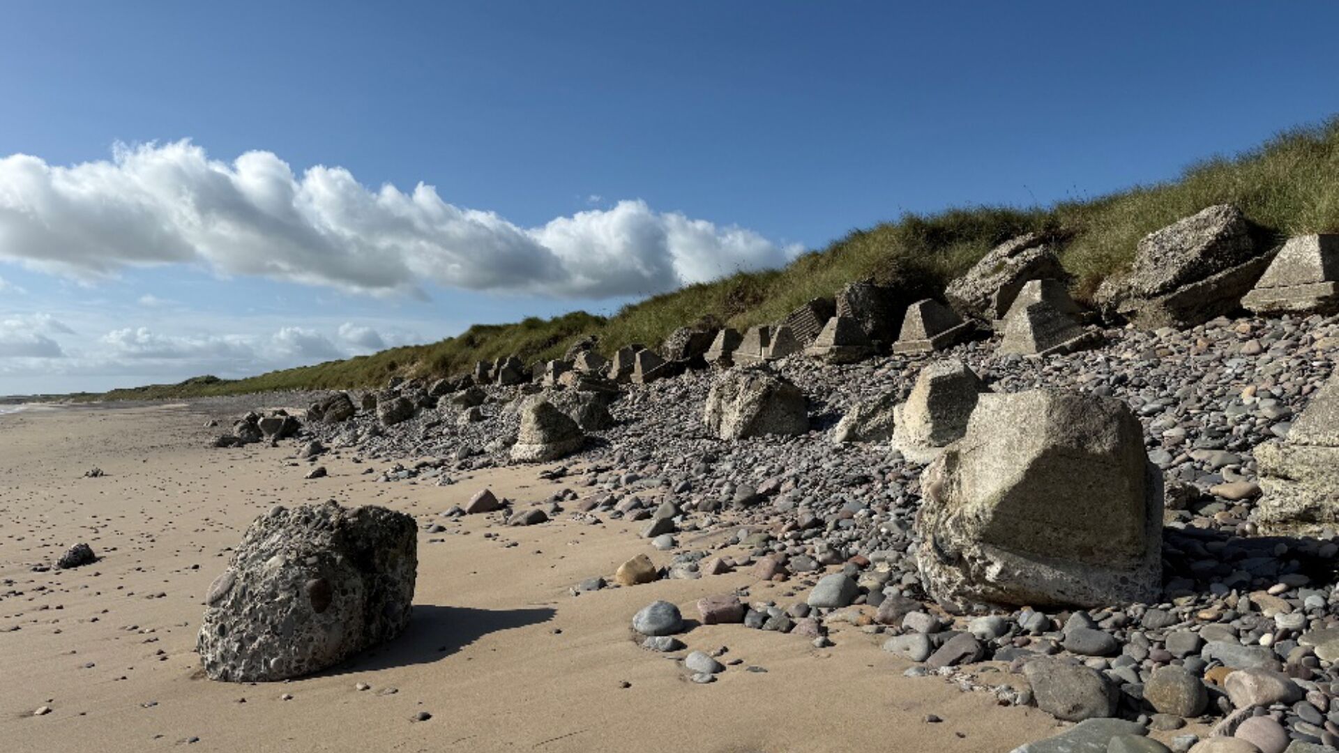
Onshore, the story continues at Sinclair’s Bay, where evidence remains of the extensive defences built along the coastline during the Second World War.
Here, we take a closer look at some of the stories revealed through the work undertaken for Ayre.
HMS Duke of Albany
Built by the John Brown shipyard in Clydebank and launched in 1907, HMS Duke of Albany originally operated as a passenger ferry. On one voyage, she carried one of Titanic’s anchors to Belfast.
Requisitioned by the Admiralty in 1914, she was sunk in the North Sea, east of Caithness and south-east of Orkney by a German submarine in 1916 and is now a protected wreck. Of those on board, 81 members of the crew were rescued, but sadly 25 were lost.
SS Clan Mackinlay
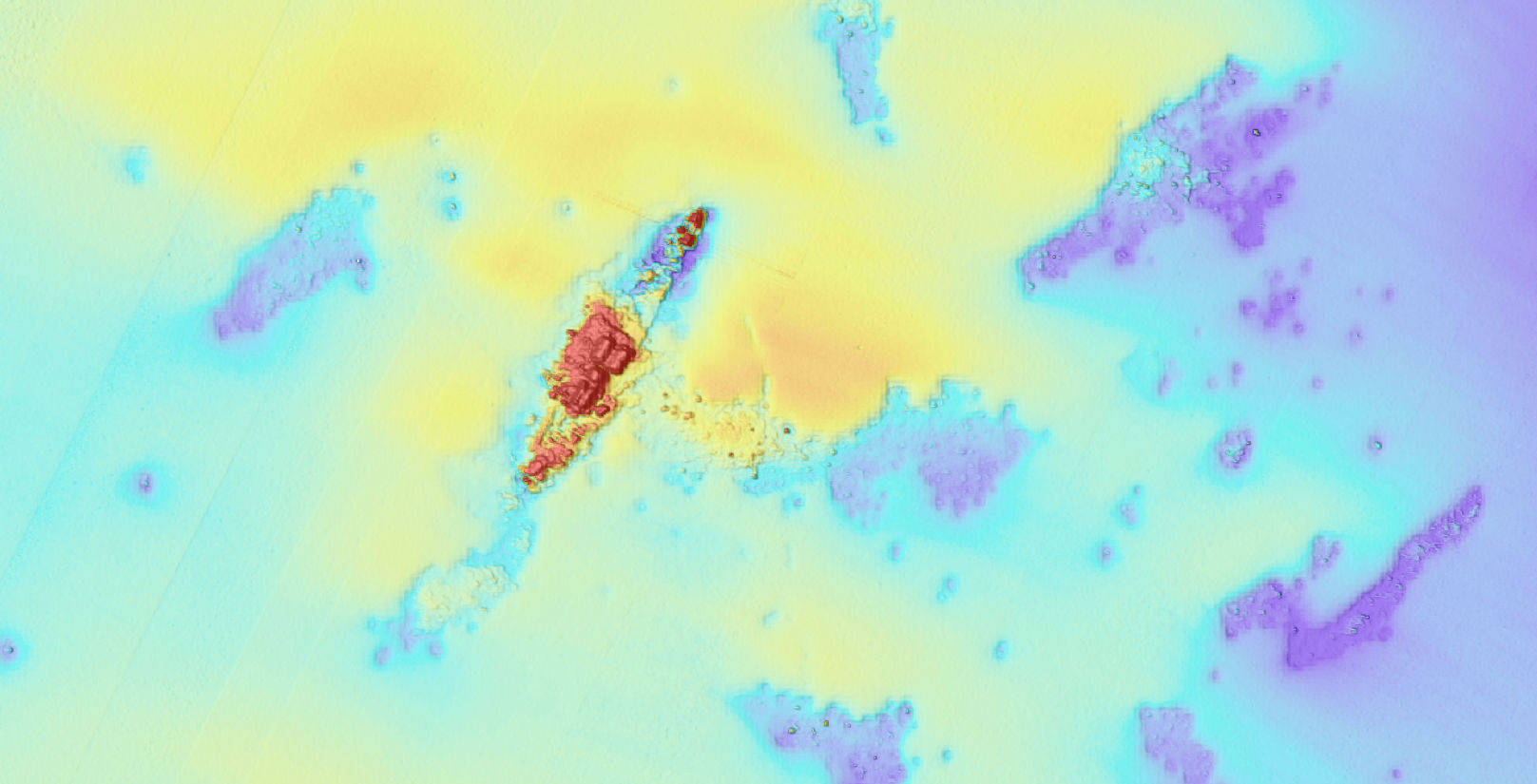
SS Clan Mackinlay was built in 1918 by William Hamilton & Co. in Port Glasgow.
In November 1940, while on convoy duty, she was attacked and bombed by a German aircraft and sank in the North Sea, east of the Caithness coast. Sadly, five of her 82 crew were lost.
A wreck without a name
Not every feature identified during the surveys has a known story.
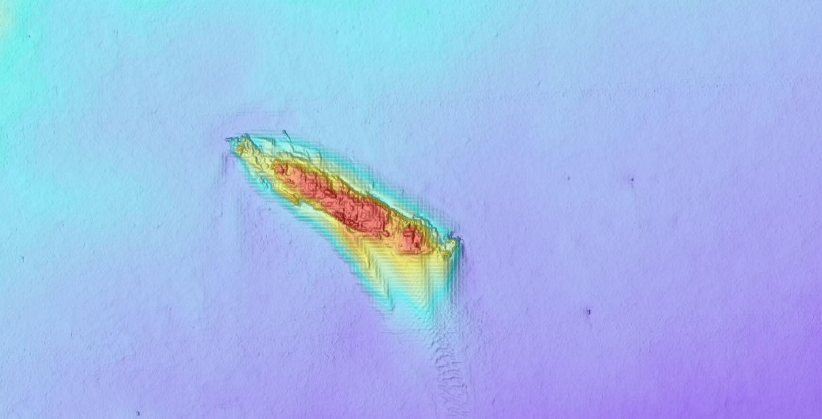
One of these is AY25_086, a wreck identified within the proposed array area. Measuring approximately 31.2 metres long and 6.3 metres wide, and standing around 1.5 metres above the seabed, it produced a strong magnetic response during the survey and has been assessed as being of high archaeological potential.
The wreck in the North Sea, east of Orkney and north-east of Caithness corresponds with UK Hydrographic Office record UKHO 69417, but its identity remains unknown.
We know where it lies and something about its size and character, but we don't yet know who sailed on it, where they were going or what happened to its crew.
A Victorian connection beneath the seabed
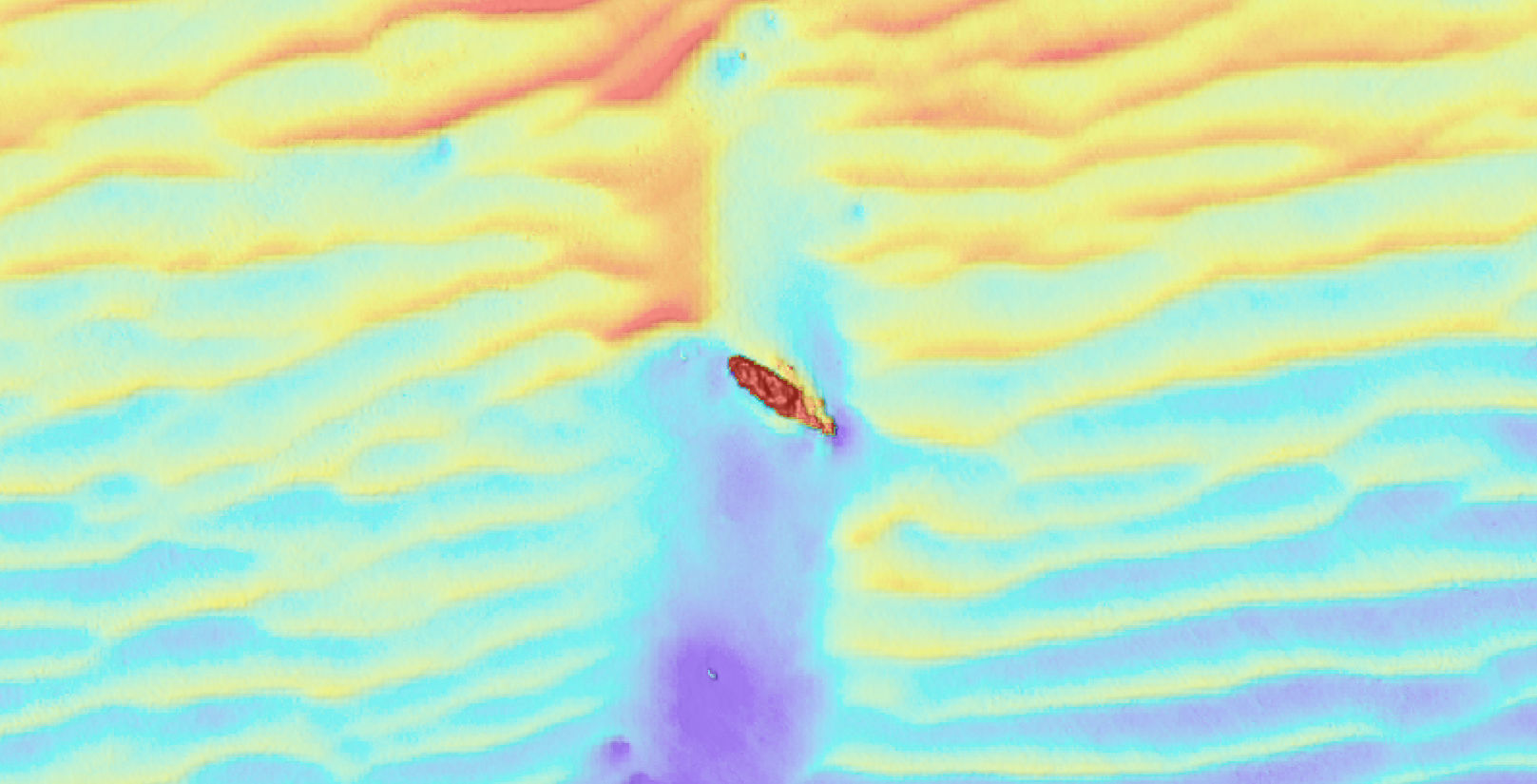
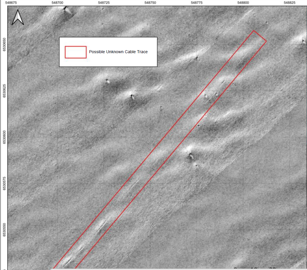
The surveys also identified a possible trace of a submarine telegraph cable that once connected Caithness and Shetland.
In 1885, a General Post Office submarine telegraph cable was laid between Sinclair’s Bay and Sandwick Bay in Shetland, covering around 122 nautical miles. For many years, it was the longest government-owned submarine cable in British waters.
The connection enabled direct communications between the mainland and Shetland and was particularly important to the herring industry.
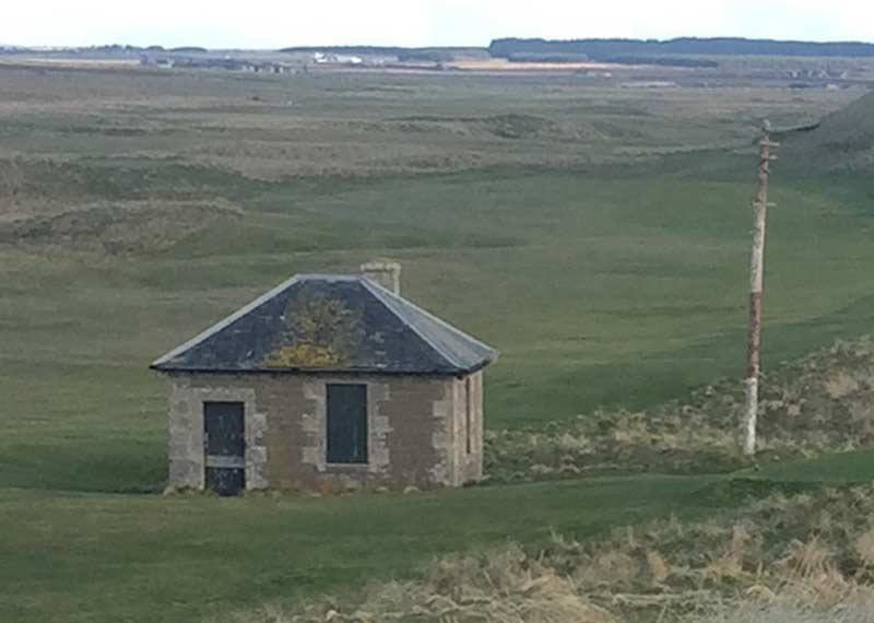
The cable was laid by the Monarch, built by J&D Dunlop & Co. in Port Glasgow and launched in 1883 as the first cable ship built specifically for the General Post Office. A cable house on Reiss Links also remains from this period, and engineers were still testing the connection in 1945.
Sinclair’s Bay - a beach prepared for war
Today, Sinclair’s Bay is a beautiful stretch of coastline, but during the Second World War it was regarded as a potentially vulnerable invasion beach.
In 1940, more than 3,000 mines were laid along the bay. According to Caithness at War, it was said at the time to be the largest minefield in Britain, stretching for around three and a half miles from Keiss beach towards the south of the bay.
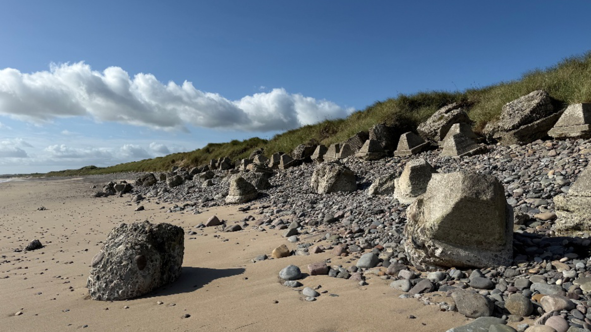
The minefield formed part of a wider system of coastal defences, including anti-tank obstacles, pillboxes, barbed wire and other beach defences designed to make an amphibious or airborne landing difficult.
The long, firm beach, together with the strategic importance of nearby RAF stations, Wick Harbour and the wider Caithness coast, made the area important to defend.
Between 1945 and 1947, the Royal Engineers, assisted by German prisoners of war from Camp 165 at Watten, worked to clear the minefield. Caithness at War records that all 3,000 mines were eventually located and destroyed.
Evidence of this period can still be found around Sinclair’s Bay today, providing an insight into how the coastline was prepared for war and the enormous effort that followed to make it safe again.
Understanding our project area
The proposed Ayre export cables will make landfall at Sinclair’s Bay, bringing together two very different chapters in the history of this coastline – a landscape once prepared for war, and a coastline now being considered for a very different kind of infrastructure.
From known shipwrecks and unidentified remains to historic communications infrastructure and wartime coastal defences, the work undertaken for Ayre is helping to build a more detailed understanding of the archaeology and cultural heritage of the project area.
Understanding this environment is an important part of the work being undertaken as the proposed Ayre Offshore Wind Farm progresses.
We’re grateful to Caithness at War, whose Sinclair’s Bay and Wick trails have been developed to preserve and share this remarkable local history.